
Today would have been Mary Joan Nelson's 87th birthday. We named our Tin Wheel in honor of Sarah's mom and Sarah designed a decal that we leave each place we visit.

One of the features of the roads in this part of British Columbia is the use of free ferries to cross numerous bays and rivers. We took the ferry from Galena Bay to Shelter Bay, a 30 minute trip across the northern tip of Upper Arrow Lake.
 |
| Boarding begins |

 |
| On the Galena Bay Ferry |
The ride from Nakusp to Cache Creek took us on the the famaous Trans-Canada Highway. Driving on the Trans-Canada Highway is a pleasure. This very well maintained highway allowed us to put a lot of miles on. We left the Trans-Canada at Cache Creek and went due north on highway 97, the Cariboo Highway. The high plains and sage brush that we passed through the day before quickly changed back to Ponderosa Pine as we approached Prince George our destination. Total miles for Sunday was an impressive 276. We made very good time and as usual saw some amazing scenery. We stopped at an antiques store in the town of Clinton. Sarah found a pair of blue cowboy boots which she had to have. Way to go Amelda!
 |
| This deer thinks it's a lawn ornament. Not an uncommon sight. |
We were disappointed that we didn't see much wildlife along this road. Despite it's name, we didn't see any Cariboo.
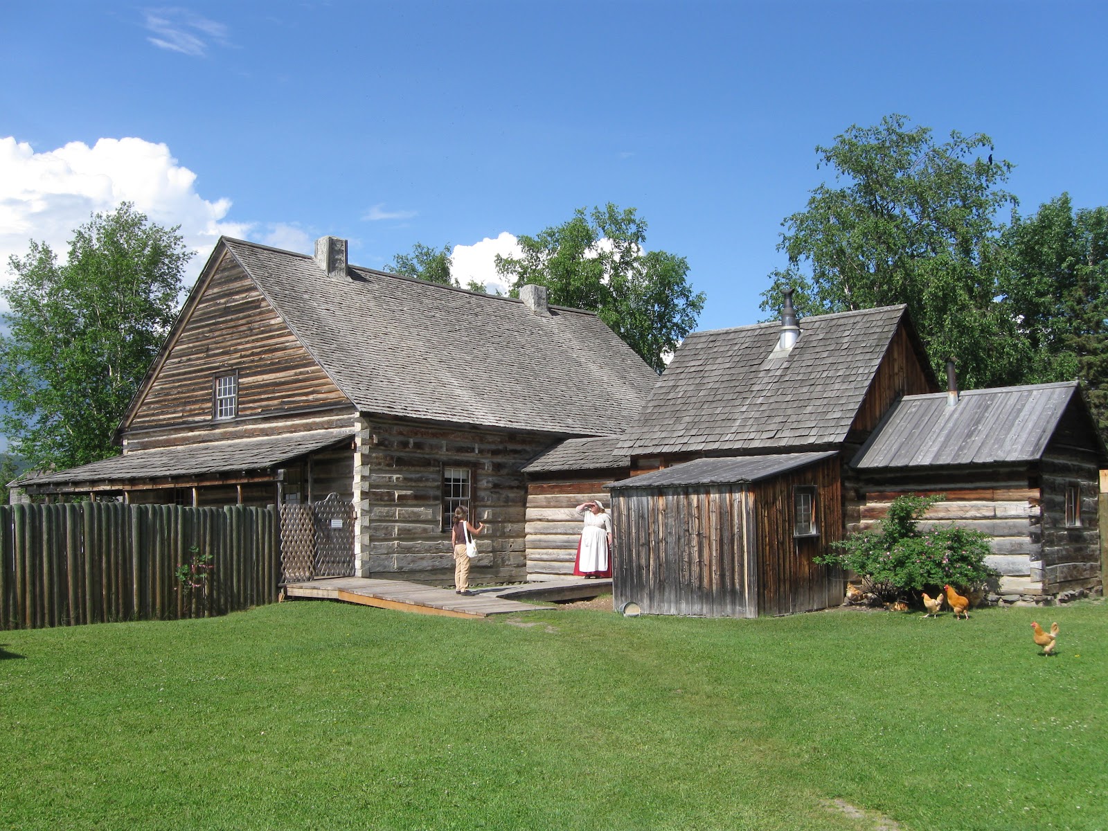
Monday's drive was a short one. We left highway 97 at Prince George and went west on highway 16 to the town of Vanderhoof. This is the place where the last spike was driven in the construction of the railroad in 1914, soon after Herbert Vanderhoof, a publisher from Chicago founded the town. Our reason for stopping here was in order to visit Fort St. James just a half hour drive north of Vanderhoof at the terminus of highway 27. Less a fort and more a trading outpost, Fort St. James was built by the Hudson's Bay Company about 15 years after it was established as a trading post by the trapper Simon Fraser. Our tour of the fort was was very intimate. Aside from the people that ran the park and acted as costumed interpreters, we were the only people there for the first hour of our visit. Even then, only two other couples arrived later.
During the tour, we learned about the important role this outpost provided in trade with the Carrier First Nation (the indigenous nomadic people of the area). Their population had been greatly diminished prior to their first contact with white people due to trade with other peoples who had contact with white people years earlier. Small pox was spread to them along with the blankets for which they traded. Their way of life was changed significantly due to contact with the white traders. The introduction of deer and moose that came along with the railway allowed the native people to make better winter clothing which allowed them to capture more fur bearing animals in the winter to meet the huge European demand for quality furs. Unfortunately, the deer and moose competed with the elk and cariboo. Because of this and increased warming over the last eighty years the populations of these two animals has been greatly reduced in this part of British Columbia.
 |
| Stuart Lake viewed from Fort St. James |
At the end of our tour we learned that the park also hosted a B&B right in the original building that housed the fort administrator. As luck would have it, the B&B was available for this evening. So, we will be staying in the fort tonight. Our stay includes dinner this evening and breakfast in the morning. We eagerly anticipate this wonderful opportunity. After one month on the road, it will be our first night sleeping in a permanent structure.
 |
| This will be our home for the night. |
Stay tuned for more.
No comments:
Post a Comment
I appreciate all comments whether about content or style