Friday, January 5, 2018

Wandering Once Again


Get out while the getting is good

Security Camera View less than 24 hours after our departure


As evidenced by the date of my last post on this blog it has been much too long. The lapse in adding to the blog was not for lack of travels and adventures because there has been plenty of that. Mostly, attending to medical issues and completing necessary home maintenance kept me away from the keyboard. But we are happy to be back on the road once again.


Together with our friends, Liz and Jack, we left New England at the end of the first week of December just before the first snow arrived. In fact, we left a day early to avoid driving during the first snow of the season. Nevertheless, we were forced to change our route south and finally got stopped by an early storm that swept across the southern states. Early in the afternoon of our second day on the road we encountered snow squalls near Columbus, Ohio that became steady snow with accumulation by the time we were about fifty miles north of Louisville, Kentucky. The highway quickly became very slick  such that just a light application of the brakes caused the trailer to begin to slide sideways. Fortunately, there was a rest area less than a quarter mile ahead so we joined the many truckers and other RVs and stayed the night. It was a good decision because the next day we saw several cars in the ditch, two of which were flipped over.

Gulpha Gorge Campground, Hot Springs National Park


We put in three more long days stopping at TO Fuller State Park on the outskirts of Memphis, Hot Springs National Park, where we relaxed for two days, then pressed on to Tyler and Mother Neff State Parks in succession before resting in New Braunfels, Texas where Liz and Jack rejoined us after they made a detour to the factory where their Casita camper was made so they could affect repairs to their furnace. We stayed at the Landa RV park in New Braunfels where we were happy to find inexpensive camping with full hookups within walking distance of the many shops, restaurants and cafes in town. In the neighboring community of Gruene (pronounced "Green"), we spent an evening listening to Ray Wiley Hubbard perform at the venerable Gruene Hall where many famous musicians such as Lyle Lovett, Willie Nelson, Townes VanZandt and so many others have performed to enthusiastic audiences.
. We returned the next day to browse the shops and have lunch in Gruene. If you enjoy good coffee, the Gruene Coffee Haus sells freshly roasted coffee at grocery store prices. We bought a pound each of their Sumatran and Costa Rican beans.
Sarah buying bread and sweets at Naegelin's Bakery, the oldest in Texas


Enjoying the band at the Pour Haus with Jack and Liz

From New Braunfels we made a short trip further west into the beautiful Texas Hill Country to Guadalupe River State Park which we used as a base camp to explore the towns of Sisterdale, Luckenbach and the beautiful town of Frederickburg. Our friends went off to explore the town of Bandera where we joined them in order to enjoy yet another night out at an old Hill Country Dance Hall to see Steve Earles play at John T Floores in his home town of Helotes on the outskirts of San Antonio. Floores dance hall has hosted nearly every well known American country and musical roots musician. One would never have known we were in, arguably,  one of the reddest states in the Union when Steve Earle sang some of his newest songs with stridently liberal political content.

Bandera, Texas


Steve Earle with the Mastersons at Floores

We could have spent a lot more time in the Hill Country, but we felt we had pressed our luck about as far as we should with the weather and therefore made tracks for West Texas. Two more long days with an overnight stop in the community center parking lot at Langtry, Texas brought us to Big Bend National Park's Rio Grande Village Campground. Even though we only had one night at Rio Grande Village we managed two beautiful hikes. The afternoon of our arrival we hiked from the campground about three miles to the hot spring on the Rio Grande River and the next morning before departing we hiked a couple miles south of the campground to a small hill overlooking the river.
Sarah with Liz and Jack in Lantry

On December 23rd we pulled into Retro Rents RV park in Terlinqua Ghost Town just west of Big Bend National Park. As of this writing Retro Rents only has two sites available for transient campers, the other sites are occupied by vintage Airstreams and Argosy trailers that they rent out. Together with Jack and Liz we celebrated Christmas making a southwest Christmas feast, exchanging presents, sitting around a campfire, listening to live music at the Starlight Theatre and playing board games until late into the night. Jack is the master of the game Blokus. We took a couple more day trips to hike some trails on the western edge of the park that we hadn't done before. Then Sarah and I drove north to Elephant Mountain Wildlife Management Area while Liz and Jack returned to the Cottonwood Campground inside Big Bend NP for the couple days we had before our reservations in Marfa for our New Year's reservations at the Tumble In RV Park where Sarah first met Jack and Liz five years ago.
Looking over Rio Grande from above Rio Grande Village Camp Ground, Big Bend National Park

Near the Western end of the Chimney's Trail, Big Bend National Park

Christmas at Terlinqua Ghost Town
The Dorgan House, an early farmhouse on the floodplane of the Rio Grande in the western
part of Big Bend National Park

Looking north from St. Elena Canyon, Big Bend National Park

The Tumble In is an easy walk to the small town of Marfa. In addition to its appeal to artists and those strolling through the art galleries, the town is known for the phenomenon known as "The Marfa Lights". Over the course of many years people have reported seeing strange and inexplicable lights east of the town. The reported sightings have drawn so many visitors that there is a designated rest area where people can safely park at night in hopes of getting a glimpse of the ghost lights.
Christmas Sunrise at Terlinqua Ghost Town
Elephant Mountain Wildlife Management Area, South of Alpine Texas (Rt/118)
Chalk House in Elephant Ear Wildlife Management Area

Because Marfa and the nearby town of Alpine have elevations well above 4,000 feet the weather can be extremely variable from day to day and minute to minute. We arrived on the 30th of December and was greeted by sunshine and temperatures in the upper 60s. The next morning the sun rose bright and the day promised to be a repeat of the day before. But, in less than an hour the temperature dropped nearly 30 degrees and the wind howled out of the north sending tumbleweeds as big as small cars careening across the open fields and the highway. Our plans of New Year's eve around a campfire were dashed. But, while Sarah was walking in town the afernoon of New Year's eve she spied a billboard advertising a celebration in town we had somehow missed. The Hotel St. George was holding a party at the St. George Hall with live music highlighted by Texas singer/songwriter Jimmy Dale Gilmore along with three other acts. Tickets were available and thus we enjoyed a New Year's Eve that we all agreed was the best we ever had.
New Year's Eve Moonrise over Marpha, Texas


Jimmy Dale & Colin Gilmore, Butch & Rory Hancock with the Masteron's
Cold Front arriving at Marpha, Texas

Since the weather forecast predicted more cold and potential freezing precipitation, we four decided to leave a day early and find warmer weather further to the southwest and at a lower elevation. Stay tuned.

Friday, July 1, 2016

Making Tracks and Heading for Home


Despite our promise to keep moving slowly and take one month to travel, once the decision to return home was made, it was a difficult promise to keep. Like the horse heading back to the stable, we were excited return to our beautiful home and welcome spring's arrival to Massachusetts.
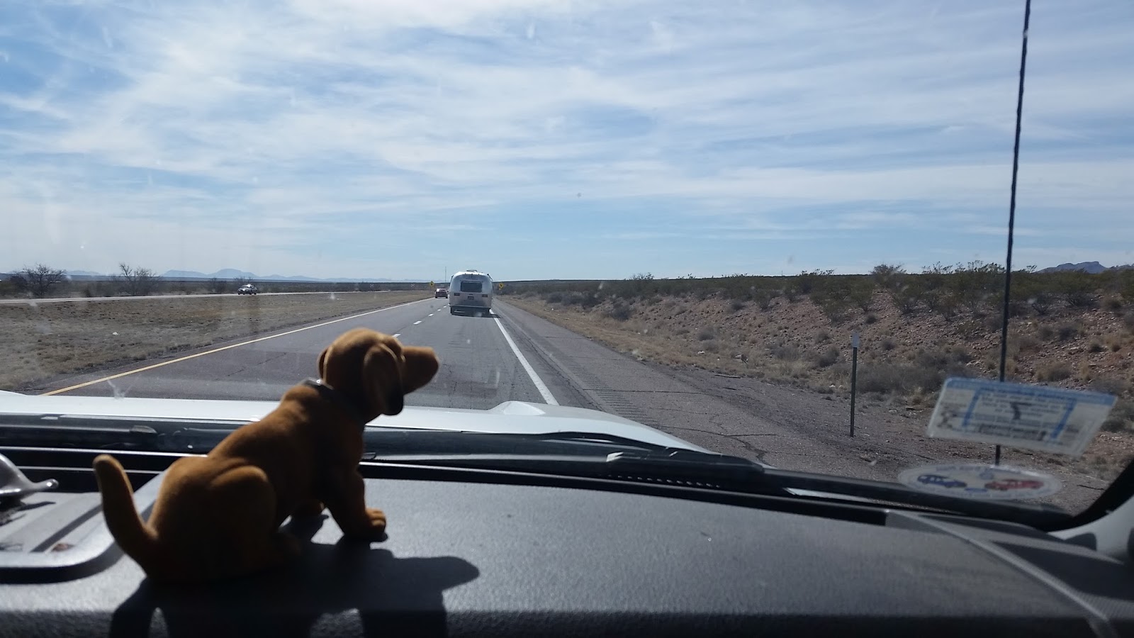
We don't see too many Airstreams while traveling

I have a cousin who lives just outside of Phoenix. Phoenix has been a mandatory stop on our southwest adventure not only because of the beautiful Lost Dutchman State Park (see our blog entry here:****), but also to visit my cousin and her mother, my aunt who passed away earlier this year). Because we bypassed Phoenix on way west and not wanting to leave Arizona without visiting my cousin we did a long day's (for us) drive from Anza Borrego Desert State Park to Goodyear, Arizona.

We stayed at the county park in Goodyear in the overflow area because the regular sites were all taken. Situated in a couple of large, gravel paved parking lots, the overflow area was actually very attractive. We especially like the elevation that afforded us a great view overlooking the city. Sarah and I enjoyed a nice dinner with my cousin, Lynn, and her partner, Tom.

With this being our third trip to the southwest, it was difficult to find routes that we had not traveled before. There are only a few roads available in this vast and rugged terrain, but we were able to connect a few stretches of scenic roads allowing us to see new territory. From Phoenix we took US 60 through Globe then on to Show Low, a town we have stayed in before. This time, we stayed at the Scott Reservoir Campground just 7 miles south of Show Low on Penrod Rd. The camping season had just begun the day we arrived. Sadly, the place was a mess with trash everywhere. Clearly, the campground had been used by people from the area as a 'party' destination. But, we just needed a place for the night, and even with the trash, it was superior to staying in a Walmart parking lot.

Continuing 145 miles east the next day took us through beautiful mountains where there was still a little snow persisting on the northern slopes of the mountains and beneath the evergreen trees. We stopped at Pie Town to buy, you guessed it, pie. This little town, sitting on the Continental Divide, has several shops offering home made pies for sale. We chose a little settler's log cabin, set back from the road that had a small sign advertising pies. The Pie Source is in the cabin. Cyndi serves coffee and and soups in addition to her fine pies. In front of the cabin are a number of interesting antique windmills decorating the yard.


From Pie Town it was a short drive to Datil Well campground where, like in Show Low, the campground had just opened for the season. Unlike Show Low, however, this campground was immaculate. We were only one of two rigs in the campground. Since it was so early, and the chance of a hard freeze remained, we had to dry camp as the water and power had not yet been turned on. We didn't mind at all because the recreation area had a nice hiking trail that wound around and to the top of a nearby hill rewarding us with wonderful views from the Datil Mountains across the Plains of San Agustin to the Gallinas Mountains to the northeast. On our hike, we saw lots of sign of elk, but we didn't see any on the hoof.

 Keeping our eagerness to get home in check, we drove only about 160 miles today. Our route took us through the town of Capitan where Smokey the Bear is buried. His grave is in the garden adjacent to a small museum dedicated to him and forest fire fighting. We had visited the museum and Smokey's grave a couple years ago.

Our destination was the Rob Jaggers Campsite at Fort Stanton Snowy River Cave recreation area that is run by the BLM. Located just a short distance southeast of Capitan, the campground is in an open field that is clearly set up for the convenience of horse owners to camp and trail ride with their steeds. Once again, because it was so early in the season, except for two horseback riders, one other camper and the full time caretaker, we had the place to ourselves. It wasn't until I was writing this post that I learned of petroglyphs in the park. We will definitely need to return here.


From Fort Stanton we continued east on US 82/380 through Roswell, New Mexico to Brownfield, Texas where we turned north on US 62/385 toward Lubbock, Texas. Northwestern Texas does not have as much public land as other parts of the state. To get to a state park from Fort Stanton would have required well over 300 miles, a distance we were unwilling to do in one day. We also needed an oil change for the truck, so we chose to stop in Lubbock. We mistakenly confused a private resort on a man made lake for a county or state run facility. We pulled into the Buffalo Springs Resort which is a community of private homes with a campground. Like too many campgrounds that are in close proximity to urban areas we were disappointed by the unkempt nature of the facility and the rowdiness of the campers who used the campground as place to escape and party. The grounds were bare dirt and the 'roads' were indistinguishable from the rest of the area. We had an early morning appointment for the oil change for the next day then enjoyed visiting the Buddy Holly museum that afternoon and departed the next morning bound for Palo Duro Canyon State Park.

Since the drive from Buffalo Springs to Palo Duro was only about 125 miles, we put the GPS into "avoid highways" mode. Still, it wanted to send us onto Interstate 27. I had picked up a detailed map of the state and used it to determine our route. Based on all of our previous experiences with the roads in Texas, I felt confident towing the Mary Joan on county and "Farm to Market" roads. This day, however, that was a mistake. In this part of Northwest Texas, unlike everyplace else, these roads began as paved roads but turned to washboard gravel roads after we had committed some hours of driving on them and it was too late to turn back. We were forced to slow down to 10 mph to travel without inflicting damage to the trailer.

Because we drove so slowly, we arrived at Palo Duro Canyon State Park in the early afternoon. By the time we arrived, all of the walk up (camp sites that cannot be reserved) were gone and the campground was filled which was not surprising because it was the week of spring break. Luckily, just outside the park entrance was a private campground that had plenty of spaces. We quickly settled in then drove into the park to hike within the second largest canyon in the United States. While most of the canyon is private land, Texas has preserved a spectacularly beautiful section. Besides the beauty of the canyon, it boasts some of the finest example of cap rocks. These hard igneous rocks that overlay softer sedimentary rock stand atop the pillars that were created due to the protection the harder rock provides for the softer rock below resulting in pillars of rock with 'hats' on top.
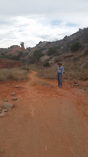
Palo Duro Canyon
On our hike to view the cap rocks we saw our first rattlesnake on a trail in the southwest. Walking along the trail my eye was drawn to movement on the side of the trail and I spied a snake disappearing behind a rock then saw it re-emerge on the other side. It stopped when it saw me. I continued ahead on the trail. It then continued to watch and I was amazed that it did not shake its rattle. I motioned to Sarah to come see and we both stood and watched as it crossed the trail behind us and vanished into the brush. While we were watching, other people stopped on the trail and we pointed out the snake. Afterwards I commented on the fact that the snake didn't rattle. One of the people who stopped said the snakes in this canyon have evolved so as not to rattle since those that did were attacked and killed.

Another canyon would be our home for the next night. We left early because we had 250 miles to reach Red Rock Canyon State Park in Oklahoma about 40 miles west of Oklahoma city. This place was also quiet this early in the season. The park is in a narrow canyon formed by soft red sandstone from which the park gets its name. It is obviously a summer getaway place for people from the Oklahoma city area. It has a swimming pool and numerous places where people can set up ropes fixed to the top of the canyons walls and rappel down into the canyon.

Concerns about the weather was now on our minds. We were now in tornado alley and the reports were calling for severe weather the next day. We decided to be on the road at daylight and move as quickly as possible across the rest of Oklahoma and all of Arkansas to reach Memphis. Hopefully, this 650 mile day will stand as record that we will never break. We endured the day by promising to spend a few days in Memphis and enjoy the music and food the city is famous for. While still subject to severe weather, we believed it would be safer to put Oklahoma and Arkansas behind us and rest up in Memphis. Our decision proved timely since severe thunderstorms with hail were just behind us as we raced east toward Tennessee.

We found Meeman-Shelby State Park just 20 minutes north of Memphis to be a convenient base from which to enjoy Memphis. The storms that followed us from Oklahoma delivered heavy rains for each of the three days we spent at Meeman-Shelby, but since we were exploring a city and not hiking we didn't mind. During our stay we visited the Metals Museum, the Gibson guitar factory and of course , Graceland. Each evening we enjoyed the food and music at one of the many venues on Beale Street.
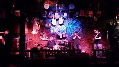
Good music on Beale St.


Friends of ours told us to have lunch at what he believed was the best BBQ in Tennessee, Central BBQ on Butler Ave. It was fine BBQ, indeed. On leaving the restaurant, we accidently stumbled upon the National Museum of Civil Rights which was just across the street. The museum is housed in the former Lorraine Motel where the Reverend Dr. Martin Luther King, Jr. was assassinated. Visiting the museum was a deeply moving experience. Rather than a museum, it felt to me more like a shrine because the subject matter was so profound and it presented the weighty moral topic in an engaging yet solemn manner.

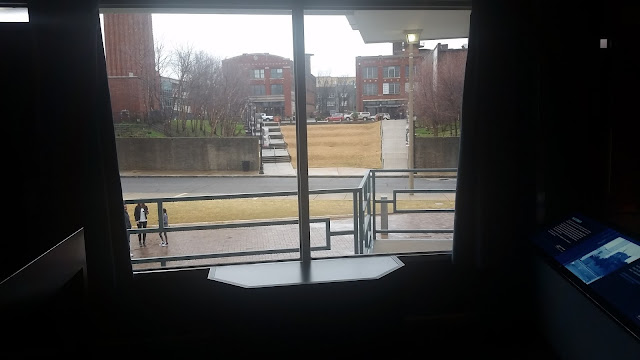
Balcony where Reverend Dr. Martin Luther King was assassinated

Keeping our promise to not rush, we set our sights on the Land Between the Lakes on the Tennessee and Kentucky border. The most direct route US 70/79, a distance of only 155 miles, but we decided to take the more scenic US51 north to Dyersburg, TN then east on TN104 where we joined US 70/79. The Land Between the Lakes is a 5 mile wide peninsula running approximately 75 miles north and south bounded by the Tennessee River on the west  and Lake Barkley on the east. The entire peninsula is the Land Between the Lakes National Recreation Area with numerous campgrounds along the entire length. We stayed at Piney Campground. With 384 campsites, it is the largest campground we have ever stayed at. Almost all campsites have a view of the water, ours was directly overlooking the magnificent Tennessee River.

Traveling northward in the late winter it can be difficult to find campgrounds that are open in state or national parks. That was the case after leaving Tennessee. The Twin Knobs Campground on Cave Run Lake in the Daniel Boone National Forest wasn't scheduled to open until March 15, but it was only March 14. However, there is a large parking lot at the boat launch where  boondocked for the night.

Some state parks in Pennsylvania are open all year and Lackawanna State Park, a perfect distance for the next days drive to the northeast is one of them. Once we are so near to home, we are less interested in scenic destination than the desire to back in our home. Therefore, we don't have much to say, or even remember about some of these stopovers. I note is so that we will remember the next time we are just passing through.

We left Anza Borrego Desert State Park on February 28 and arrived home on March 16, a journey of over 3,000 miles. Stay tuned for more.


Sunday, February 28, 2016

More Fun in the California Desert

Early morning rainbow at Culp Valley Campground. The rain never made it into the valley.
Our friends, Liz and Jack, told us that we should visit Anza-Borrego Desert State Park in Southern California. Since we wanted to continue west to El Cajon, California and meet up with a friend I've known since childhood and the park was on the way we decided to make it our next destination. The route we chose to depart Death Valley took us west on state route 190 to the Panamint Valley and then state route 178 south. We hit a stretch of resurfacing on this road that presented us with four miles of the worst washboard we have yet to experience. The fastest we could travel was seven or eight miles per hour.

Since it was Super Bowl weekend we wanted to be in a town with a good sports bar. We decided to boondock on BLM Off Highway Recreational Vehicle Area just 15 minutes from Ridgecrest, CA. Ridgecrest is at the gate to the U.S. Navy's China Lake  Weapons Testing Grounds. My research told me that the Navy put a lot of effort into attracting highly educated and skilled scientists and technicians to such an isolated and harsh place. The efforts apparently paid off because the town is rather charming with nice restaurants and shopping. Unlike most "military towns", the main street leading to the base was not a series of pawn shops, predatory lenders and "gentleman's clubs". Rather their were nice restaurants and shops.
Off Highway Vehicle recreation site, southeast of Ridgecrest, CA
We watched the superbowl at Schooners Patio Grille where the walls were lined with large televisions providing excellent viewing for everyone. Sitting beside us were two British Airmen who appreciated our assistance understanding the rules of the game. The crowd was about evenly split about whom they were cheering for. And, despite several patrons who had obviously not paced themselves in the amount of alcohol they were consuming, the crowd was generally well behaved.

Sarah and I celebrated Fat Tuesday at a fine French Restaurant, Mon Reve. The restaurant is small and unpretentious offering a small menu of French country cuisine by a very charming owner, Herve. Hevre waits on the tables and his wife does the cooking. Unfortunately, we didn't get to meet the chef.

Our next stop along the way to Anza-Borrego was at the Applewood Campground in the San Bernadino National Forest just north of San Bernadino. We were saddened to see that this campground is inhabited by homeless people, some of whom had automobiles and others that did not. The campground is rundown, ill-kept with vandalism to the park buildings and grounds. At other campgrounds near metropolitan areas we have experienced the occasional camper we suspected was homeless. The clues are not so subtle, they often have older rundown cars and makeshift camping equipment and they avoid even the simplest social contact. We stayed the night and moved on to Dripping Springs State Park. Being that it was Washington's Birthday and thus a long holiday weekend, we were lucky to get a campsite on a Thursday afternoon before the park filled up. We stayed four nights and enjoyed the hikes that led us high into the hills overlooking Temeculah, California. Temeculah is just a 20 minute drive from the campground. It is an upscale small city with good shopping available, Sarah found a Trader Joe's, and a beautiful library that we took advantage of for good internet connectivity. A drive through Old Town confirmed for us that we were in Southern California. On the warm and sunny Sunday afternoon, everyone in the county seemed to have descended on the small shopping and dining district.

With the weekend crowds thinned out, we headed for Anza-Borrego Desert State Park. This is a huge park surrounding the town of Borrego Springs. The weather was exceptionally warm, upper 80s to lower 90s in the valley, so we chose to stay at the Culp Valley Primitive campground that is 3,000 feet higher and 10-15 degrees cooler. The campground is primitive in that there are a few rutted roads meandering through a relatively level open area among the huge gneis boulders with haphazardly situated places where one could get off the road and place a tent or RV. Other than a vault toilet, there are no services. Our campsite backed up to a level area among the boulders with a commanding view of the valley to the east where we ritually watched the colors change each evening at sunset.
Looking east from Culp Valley near sunset.
Our neighbors watching the moon rise from Culp Valley

Anza-Borrego is home to a small and threatened herd of Bighorn Sheep, Borrego in Spanish, and nearly limitless places to hike and explore the washes, canyons and peaks of the park. The rangers and volunteers offer a surprising variety of guided hikes educating visitors about the geology, ecology and history of the area. Sarah and I especially enjoyed hiking trails that led to seasonal springs and the oasis they provide in this desert. Unlike Death Valley, the El Nino rains had missed Anza-Borrego so the wildflowers were not as magnificent. Here we had to slow down and look closely to see the beauty and diversity of each section of this desert. It reinforced, for us, that from the window of a speeding automobile it is impossible to appreciate the full beauty of a desert. We were told that a small flock of sheep had been seen regularly just a mile or  so from the campground at Palm Canyon. Indeed, they we were easy to find. The five sheep seemed completely indifferent to the dozen or so people who quietly watched and took photos of these beautiful creatures.
This ram didn't seem to mind having his picture taken.
Hiking in the Slot. A deep narrow canyon.
Entrance to The Slot

The town of Borrego-Springs has several restaurants, hotels, RV parks and shops. Once again we took advantage of the public library that provided nice benches with electrical outlets for those of us who needed internet connectivity.
Sculpture Garden in Borrego Springs

The Agave blooms once, then dies.

The bees love Agave
Discovering water in the desert is magical. The presence of water creates oasis where the flora changes dramatically in just a few yards. The heat of the desert vanishes as cool breezes envelope you. A hike in the desert that culminates with a waterfall is a magical experience.
The presence of broad leaf deciduous trees as well as the palm trees told us that water was ahead.
Maidenhead Falls in Hellhole Canyon.

Among those who tow campers there is an ongoing debate about the necessity of 4WD for one's tow vehicle (TV).  Sarah and I have concluded that 4WD is a wonderful luxury, if not a requirement for our purposes. While I can only think of three times in the thousands of miles we have traveled that we needed 4WD capability to tow the trailer, having the option has allowed us to explore many places we simply could not have without it. The drive into Coyote and Sheep Canyon cemented that belief in our minds. The drive into Coyote Canyon to Sheep Canyon involved driving through soft and deep sand, crossing a stream three times, and climbing up narrow rock strewn washes. Even still, we could not go where the short wheel bed vehicles could go, forcing us to hike eight miles round trip find the oasis in Sheep Canyon.
We enjoyed the cool water in Sheep Canyon

After eight days at Culp Valley we made short drive to Cleveland National Forest. Our intention was to stay at Cuyamaca State Park's southernmost campground. However, the information I received from the ReserveAmerica person I spoke with that the Green Valley campground was open and reservations were not required was incorrect. The campground was closed until April 1. However, we found the Oakzanita Springs Thousand Trails campground just a couple miles away. Despite our preference to stay in State or National Parks we pulled in and signed up for two nights because our purpose for being in this area was to visit a lifelong friend and his wife who live in El Cajon. We were warmly welcomed to the campground by the gate attendant. He cheerfully drove us around the park helping us pick which site we wanted. While most of the sites are small, and not all have full hookups, we found a nice spot big enough to fit our 31' trailer and still have room to park the TV in front. Like so many other commercial parks we have visited, this one seems to have significant population of people who are living in travel trailers. Clearly, many of the motorhomes and trailers, though well maintained, haven't moved in a long time. But it is quiet and would serve our purposes. Sarah took advantage of the clean laundry facilities and we  enjoyed having the large hot tub that evening completely to ourselves in the full moon's light.  The town of Alpine, just 20 minutes away, has good grocery stores, restaurants and shopping.

We returned to Anza-Borrego two days later. This time we camped at Mountain Desert Springs primitive campground about 25 miles south of Culp Valley. This campground easily accommodates trailers and motor homes. It is located on large, flat and open land at the entrance to a canyon with several springs and groups of the California Fan Palms. From here we were able to explore the Vallecito Badlands and enjoy the refreshing hot springs and swimming pools at Aqua Caliente that is just eight miles to the west. From Agua Caliente there is a nice loop trail into Moonlight Canyon that ascends from the springs to the head of the canyon then drops down into a canyon to the east before circling around and returning to Agua Caliente. There are two attractive side canyons begging to be explored, but they were closed due to a mountain lion having recently made a kill in the area.
Understanding the meaning of "Badlands"
From a distance it appears to be flat, but up close, BAD.


Our last morning at Mountain Desert Springs, we took one final hike into the canyon, past the springs and over a ridge to the west. On this south facing slope we discovered a few Beavertail cacti in bloom. We had been watching the buds on these cacti growing bigger by the day and we were delighted to have finally seen them in bloom. Just as we finished enjoying these flowers I noticed movement high up the steep slope. Here we watched a solitary ram come down towards us. He stopped and pondered us for a while then slowly passed us just 25 yards away. While not as majestic a creature, we also enjoyed seeing another desert dweller whose existence was evident everywhere, but we had never seen before, the desert packrat. He quickly skittered away up the slope, seemingly much more nervous than the the ram. What a perfect ending to our stay at Anza-Borrego Desert State Park.
Some of the barrel cacti are blooming
Beavertail finally in bloom

Worth the wait
I think this ram was posing for me

After almost three months on the road, it is time to begin our meander back to Massachusetts. We have set a goal of being home by April first.

Stay tuned


Friday, February 5, 2016

Off to the Racetrack


Racetrack Playa 

Racetrack Playa in Death Valley is home to one of the world's most perplexing and intriguing phenomenon. This perfectly flat dry lake bottom has stones the size of bowling balls that move across the lake bed leaving trails of their movement in the dried mud.

Many theories have been postulated as to how the stones move. But, no person has ever seen them move. The Playa is a three hour drive from Furnace Creek, Death Valley, the hub of the national park. Half of that time is spent driving 27 miles on a washboarded gravel road that will jar the fillings or crowns from one's teeth. And the gravel is not just any rock, it is chirt. Chirt is the rock Native Americans used to make arrow and spear heads. When broken, it is sharp as a razor and can shred a tire quicker than you can say "flat".

While our Ford F250 is off road and 4x4 capable, we decided to rent a Jeep. Tearing up just one tire would cost more than the rental fee. Also, I had no problem driving the Jeep's shock absorbers into oblivion. Had I been driving my Ford the trip would have taken three times as long.

We added an extra fifty miles to the trip by driving out of Death Valley towards the town of Beatty then driving back into the park through Titus Canyon. The road is a steep and narrow gravel road with hellish drop offs. But, the views were spectacular as we traversed the pass above the snowline. Along the way we encountered the old ghost mining town of Leadfield and some questionable petroglyphs.
Switch back road climbing from Beaty to Titusd Canyon
At the pass, heading down into Titus Canyon
Leadfield, a boom and bust town in 1926
Old mine shaft in Leadfield

Questionable petroglyphs. 
Once through Titus Canyon, we drove another hour to Ubehebe Crater where the pavement ended and the 27 miles of harsh gravel road would lead us to Teakettle Junction and on to Racetrack Playa.
Teakettle Junction, wish we had known to bring a pot

The road rises continually from below sea level in Death Valley to 4,000 feet before beginning the descent to the Racetrack 200 feet below. From a bluff about 3 miles away, we caught our first glimpse of the expansive dry lake bed. The mud at the lake bed is said to be over 1,000 feet thick.

Passing the Grandstand, a large outcropping of quartz monzonite rising from the center of the "lake", we drove on to the Racetrack. We were happy to see that the water from the rain of the previous week had finally evaporated and we were able to walk out onto the perfectly flat lake bed and observe the eerie tracks left by the movement of the rocks across the muddy bottom. I was especially happy to see that previous visitors had refrained from walking on the Playa while the mud was still wet.

The Racetrack is an area of dry lake bed onto which rocks from the eroding hills surrounding it have fallen. These rocks move across the lake bed leaving tracks in the soft mud. Their movement has been the subject of great speculation. Some said that hurricane force winds following a rain was the force, others said it was the ice that moved them, still others claimed there was an alien force behind the movement. In the end, it was those who believed the ice caused the movement who were proven correct. Researches attached GPS units to rocks and placed them on the Playa. They showed that after a substantial rain in the winter ice would form entrapping the rocks. As the daytime temperature increased the ice cracked. And, as it typically happens following a cold front, high winds would develop pushing the broken ice sheets along the playa carrying with it the stones leaving trails in the soft mud.
This bowling ball sized rock has moved over 600 feet

Bigger than a basketball.

We drove back to Furnace Springs after clocking 200 miles on the rental Jeep and enjoyed a fine dinner at the Furnace Creek Inn.
Panamint Mountains reflected in Death Valley
Because of the exceptional rain five days earlier and the warm weather that followed, the desert burst into a bloom of colors. They were especially profuse at the southern end of the valley. We drove 45 miles south of Furnace creek to Ashford Canyon where we were excited to find Sarah's favorite flower, Lupines, in bloom.


Arizona Lupine
The predominant flower is Desert Gold. A brilliant yellow, daisy shaped flower. It's subtle fragrance permeated the air.


The Desert Five Spot is sparsely interspersed among the Desert Gold 

Brown-eyed Evening Primrose

Lining the canyon washes are natural rock gardens featuring Notch Leaf Phacelia (purple) and Lesser Mojavea (yellow)


Stay tuned