
Our intention, after leaving Denali Naitonal Park, was to drive east on the Denali Highway. This route is supposed to be very scenic. From Cantwell, just outside the entrance to the park, this gravel road parallels the Alaska Range and joins the north/south SR4, the Richardson Highway through the middle of the range toward Fairbanks. However, low clouds and rain obscured the mountains. It didn't make sense to subject Mary Joan to such a hard ride if we couldn't see the vista. Having begun this trip at what we thought was a very early date, we now feel we should have started earlier. It would have been nice to just sit and wait out the rain. But, we have made plans to be in Winfield, Kansas in time for the 40th annual Walnut Valley Festival and that is nearly 3,800 miles to go in only thirty days. So, we continued north on the East Park Highway to Fairbanks.
 |
| View from our boon docking site on the Denali Highway |
People we met along the way told us to plan on spending a few days in Fairbanks. We don't see what could entice anyone to go to there. There is nothing scenic about this place. The several blocks that make up the downtown area consist of run down and empty buildings. The nearby visitor's and convention center had an interesting, and very well presented, museum of Alaska history. Here we learned about the Japanese occupation of the Aleutian Islands, Kiska and Attu, during WWII. We knew that the construction of the Alaska Highway was done for military purposes, but we didn't know of the very real threat Japan posed to Alaska. Except for this very informative section, this center was similar to others we have visited.
One bright star in Fairbanks is the Museum of the North. Located high on a hill at the University of Alaska campus, it is magnificent sight. The gallery on the first level displays early (late 19th and early 20th century) paintings and photographs by Alaskan artists as well as artists that visited the territory. The second level has a single gallery that is uniquely divided by curved partitions into smaller rooms that make the space feel more intimate bringing one closer to the art. Despite the juxtaposition of modern art of various less traditional media with earlier and more traditional media, there was a feeling of cohesiveness I would not have expected. The visit to The Museum of the North salvaged what would otherwise, for us, have been a waste of time.
 |
| Museum of The North |
It was the middle of the afternoon when we left Fairbanks so we decided to drive just about 100 miles to Delta Junction since Chicken, our next destination, was another 180 miles over very poor roads. It was cold and raining when we arrived in Delta Junction. It had been getting progressively colder. The two previous mornings it was below 50 degrees inside the trailer. The Tin Wheeler has two sources of heat, an electric heat pump and a propane furnace. The furnace uses a lot of propane so we rarely use it. Most of the campgrounds we stay at do not have electricity and our 1KW generator isn't powerful enough to run the heat pump, so we just use a comforter on the bed and wear our fleece to stay warm. We finally broke down and used the propane furnace though at Delta Junction. After days of rain and cold the trailer was feeling quite damp. With the heat on, we enjoyed a simple dinner of blueberry pancakes with turkey bacon. Our entertainment that night was a game of gin, which Sarah won.
Continuing on the Richardson Highway we once again passed through Tok. Anyone traveling into or out of Alaska by road must pass through here. We had lunch at Fast Eddy's, a rode side restaurant popular with locals and travelers. Sarah had a breaded chicken cutlet burger with fries and I had the halibut burger with onion rings. We both enjoyed our lunch.
Soon after leaving Tok, we turned onto the Taylor Highway toward Chicken. The next two days of driving would be the most difficult of the trip. This mostly unpaved road forced us to go very slowly but it provided grand vistas despite the overcast conditions. Pot holes, washboard sections and extremely soft shoulder were are constant challenge demanding serious concentration by the driver. But, it is the shortest way to Dawson City, Yukon and our chosen route home.
Chicken is not so much of a town, as it is a collection of three businesses. We stopped at the first of the three, Beautiful Downtown Chicken. A large sign offered free camping. It appeared that the large sloping gravel parking lot was the 'campground'. I went into the saloon and the bartender confirmed that it was indeed the place to camp, 'just leave room for others to turn around'. Sarah and I have become fairly proficient at backing Mary Joan into campsites and our skills were put to the test here, with the rain not making our task any easier. It was necessary to use four wheel drive to get the trailer onto the leveling blocks and the electric A-frame jack was pushed to its limit to raise the tongue of the trailer to level us front to back.
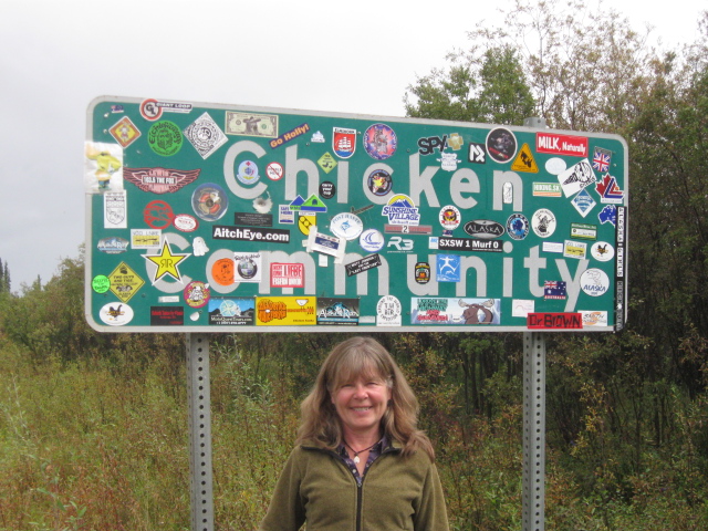 |
| Welcome to Chicken |
 |
| Placing our mark |
 |
| Say no more |
With the driving finished and the Tin Wheeler settled for the evening, Sarah and I returned to the saloon. The owner of Beautiful Downtown Chicken, Susan, was seated on the small porch along with four other people and two dogs. We each ordered a drink inside and joined the others on the porch. Sarah asked if it would be alright to bring Scout. Susan asked if he was friendly, we replied that he was alright as long as other dogs left him alone. Susan said that since he wasn't friendly, don't bring him. We respected her request and, while Susan conversed with two friends on one side of the porch, we engaged the two other men, Susan's employees it turned out, in small talk. It turned out one of them was originally from Milton, MA. The man from Milton had a miniature poodle in his lap. He told us a very sad story about this dog' sister. She was in the yard and was attacked and taken by a Golden Eagle.
Shortly, Susan asked her employees to perform some task. We tried to join the conversation with Susan and her friends, but their conversation became increasingly personal so Sarah and I diverted our attention to the scenery, finished our drinks and explored the gift shop next door. Sarah bought a few things there, then we went into the restaurant/bakery. Susan is well known for her pies, so we bought a large slice of apple/cranberry to have for desert and Sarah bought a cinnamon role for the next day's breakfast. A turkey sausage with onions and peppers plus an ear of sweetcorn for Sarah, a hamburger with the same condiments for me topped off with the delicious pie was our dinner.
 |
| Chicken Post Office |
The next day broke warm and sunny. Two bus loads of tourists were already milling about when we emerged from the trailer after breakfast. Sarah expressed her disappointment with her stale cinnamon bun, but decided not to complain and chalked it up as a contribution for our 'free' camping.
 |
| Down Town Chicken with Mary Joan in the 'campground' |
I have a departure checklist. It is a list of all the things to do, such as closing windows and vents, before pulling out of a campground. The list is laminated and each item is checked off using a dry erase marker. Early on in the trip I was very conscientious about using the list. But, after a while it seemed to be unnecessary. I had a routine and rhythm that made sure all was secure. However, this morning I forgot one item that could have proven disastrous. I forgot to raise the A-frame jack. Knowing that this is a common occurrence, I always place a number of leveling blocks on the ground beneath the jack so that if I forget to raise the jack it will not drag on the ground from the moment the truck moves the trailer. I made it about 100 yards until I felt the jack scrape the ground. I stopped the truck and raised the jack. I don't think any of the tour bus people knew what had happened when Sarah and I went back to retrieve our leveling blocks.
The Top of the World Highway out of Chicken was a thrilling experience. This narrow road, in many places one lane, twists and turns, rises and falls all the way to Dawson City. Our CB radio was very helpful on this road. Large double trailer tanker trucks would announce their position on the road in order to plan a passing. Trucks and pilot vehicles for tour buses gave frequent updates of their position along the road. A highlight of this trip was seeing caribou from the Forty Mile Herd. Once numbering more than half a million and reduced to less than 6,000, the herd is now healthy at about 20,000.
Near the peak of the Top of the World Highway we came to the 'town' of Boundary. We stopped and met Mayor Jim. He has been mayor since he bought the five acres last spring. He and his sons and step sons dredge for gold. But, truth be told, his real gold mine is yet to arrive. He has applied for a liquor license so that he can sell beer and wine at his road side attraction. Nearing our departure from Alaska, we have come to believe that there is some truth in the statement about the people who choose to live here; "we're all here because we're not quite all there". Like most generalizations, there is usually a kernel of truth behind it.
 |
| One of the Fort Mile Caribou herd |
 |
| Boundary, Alaska |
We arrived at the Yukon River Campground, across the river from Dawson City, in mid-afternoon. After getting backed into a very scenic site on the river, we disconnected the truck from the Tin Wheeler and took the ferry across the river into Dawson City. We were immediately taken by the charm of this town. The unpaved streets, wooden sidewalks, and frontier facades of the buildings made this place look as if time had stood still for a century. We were not the only ones to feel this way. For, the next day we observed the filming of a Canadian television show on the streets in this town. We had lunch and watched from our table as scenes for Murdochs Mystery were being filmed outside our restaurant.
 |
| The ferry across the Yukon to Dawson City |
 |
| Filming of a Murdoch's Mystery episode |
 |
| Sarah with the leading actor |
Later in the afternoon, we tried our hand at panning for gold. After all, gold is what made this town exactly 115 years ago to the date, August 17, 1896, when gold was found in what is now know as Bonanza Creek. We drove to Claim #6, a site owned by the public as a place to pan for gold. We learned that the image of a miner using a pan to search for gold is not how he/she actually accumulated the rare element. Rather, a miner would find an outcropping of bedrock by a stream and take samples of the overlying gravel to pan for gold. If gold was found then machinery was brought in to dredge the soil and adjacent river bed. Millions of tons of gravel were put through the sledges to separate the gold from the rock and mud. Every creek leading into the Yukon near this place was mined leaving huge piles of sterile rock as a legacy and resulting in a muddied Yukon River. Like most of those that came seeking gold, Sarah and I left with an empty pan.
 |
| Gold mining is not pretty |
From Dawson City we traveled on the Klondike Highway toward Carmacks and then on the Campbell Highway to Faro. The town of Faro is about 7 miles off the highway. It once was the residence for the mining community nearby. But, the mine is closed and more than half of the housing is empty and worn. But, the interpretaion center and adjacent campground made us feel very welcome. For only $12.50 per night we had water, electricity, sanitation and hot showers. Plus, the laundry was very reasonable.
We left Faro about 11 A.M. At the junction to Faro the Campbell Highway changes from paved to gravel and necessarily we had to slow down. Our destination is Watson Lake, but at over 200 miles distant, we cannot make it in one day. The gravel road is narrow and marred with frequent potholes, frost heaves and washboard. We could only make a little over 35 mph in many places. Driving here demands your complete attention and fatigue sets in quickly. With soft shoulders and steep drop offs, there is little room for error. Fortunately, we met only two vehicles in over 100 miles.
We stopped at the Frances Lake Campground for the night. A picture perfect camp site on the lake was open. We backed in and were immediately attacked by a swarm of black flies. I made a fire in hopes of driving them away. But, we were driven into the Tin Wheeler to avoid the persistent flies.
That night it rained. We could here it throughout the night. At times it rained so hard that Sarah thought hail was striking Mary Joan. Sarah's greatest fear is that we would encounter a hail storm that would damage the soft aluminum skin of our land yacht.
The resumption of our travel on the Campbell Highway was made with great trepidation. Our fears were not unwarranted. The rain had reduced the road to pot holes and washboard. The distance to Watson Lake was only 100 miles, but we were forced to reduce speed to 10mph at many places. It took three and a half hours to make Watson Lake despite the well paved section of the last 30 miles.
We visited the Mile Post Forrest at the visitor center upon our arrival. Begun by a worker on the AlCan Highway in 1942 putting up a sign post pointing to his home town, there are now more than 70,000 signs at the visitor center. Sarah and I will add our sign tomorrow. Pictures will follow.
Stay tuned.
No comments:
Post a Comment
I appreciate all comments whether about content or style