Friday, January 10, 2014

Big Bend National Park and West Texas


Although the distance from Seminole Canyon to Great Bend National Park is only 200 miles, we drove slowly to enjoy the magnificent scenery along the way. Towns and fuel stations are few and far between in West Texas. When we traveled to Alaska, we carried extra fuel in two five gallon containers. But, by sticking to our rule of always filling up whenever we had 1/4 of a tank or less left, we never had to use our reserve cans. So, we felt safe going without the spare canisters. That rule almost let us run out of fuel in West Texas. With a steady altitude gain and a head wind, a quarter of a tank is not enough to reach the next fuel stop. We didn't run out, but it was close. 
Confluence of the Pecos and Rio Grande (deer on the river's edge)

We drove west on US 90 until we reached US 385 where, at Marathon, a small town just north of Big Bend National Park, we turn south to enter the park. Unlike most national parks we have visited, this one has very little tourist development surrounding it. There are no McDonalds or Subways to be found here, let alone a water slide or miniature golf. 

As we drove south on US 385 the Chisos Mountains rose before us in magical purple splendor. Sarah and I each commented that we had no idea Texas had such majestic mountains. Planning to spend about a week in the park, I wanted to divide our stay between the three campgrounds, Chisos Basin in the center of the park, Rio Grande Village in the southeast and Cottonwood in the southwest. But, the ranger at the check-in station told us our rig was too big for Chisos Basin so we drove south to Rio Grande Village. At Rio Grande Village we had the choice of either a dry camping or full hookup campground. Sarah opted for full hookup. While the dry camping area was more scenic, we enjoyed the convenience of having electricity because we could use our electric heater rather than propane. The severe cold that had gripped the rest of the country also made itself felt way down in Texas. The locals were definitely complaining. We just enjoyed the 45 degree weather knowing what it was like at home.
Our first  Rio Grande overlook

Big Bend National Park encompasses 801,163 acres, some of the highest peaks in Texas and a wonderful hot spring right on the Rio Grande River. It is the 15th largest National Park. 

Arriving late in the afternoon, we took a short hike into Boquillas Canyon and got our first close up look at the Rio Grande. It was much more beautiful than I had imagined. I thought it would be a dark brown and slow moving creek. Instead, I found an aquamarine vibrant appearing river. 
Rio Grande at Big Bend National Park

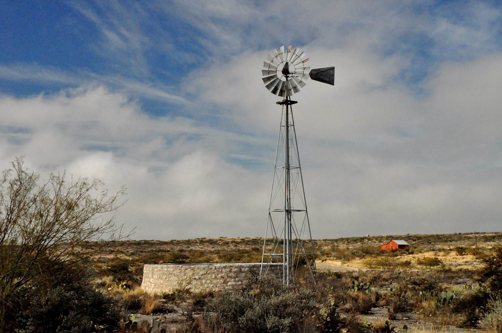
Knowing that there are black bear and mountain lions here, Sarah and I were on the road before dawn to drive the Old Ore Road in hopes of catching a glimpse of one or the other. The road is about 26 miles long and only suitable for high clearance four wheel drive vehicles. We didn't see any large mammals, but we saw lots of birds and had the opportunity to hike into deep canyons and explore the abandoned ranches and homesteads along the way. The next day we drove the 45 mile River Road that traverses the southern edge of the park parallel to the Rio Grande River. This road also demands the use of a high clearance 4WD vehicle. These park roads are one lane with nasty thorn bearing vegetation encroaching on them. Our poor tow vehicle suffered a lot of scratches from these vicious plants. When I mentioned this to one of the rangers, she said they call these scratches "desert pinstripes". With any luck they can be buffed out.
Sarah climbing to the tijana
Chisos Mountains from River Road, Great Bend National Park
Quicksilver (mercury) mining operation. The men who worked here in the early 20th century lived to be about 30 years old due to mercury poisoning.
The Rio Grande, a wild and scenic river


On the third day in the park the weather warmed a little so we decided to hike the Lost Mine Trail. Starting just above Chisos Basin the trail climbs for two and a half miles gaining 1,100 feet of altitude to arrive at 7,650 feet to awe inspiring views of the surrounding desert. We both delighted in the beautiful flora that is part of the ecosystem of this high desert. A lush oak, juniper and sumac forest provides cover for deer, bear and the ever elusive mountain lion. After the climb we rewarded ourselves with a glass of wine at the Chisos Basin Mountain Lodge followed by a welcomed soak in the hot springs near our campground.
Deer on the Lost Mine Trail
Sarah spotted this impressive tarantula
Summit of Lost Mine Trail, Chisos Mountains 


Hot spring on the Rio Grande
The next day we drove across the sloping desert to the southeast of the Chisos Mountains to hike the Pine Canyon trail. The trail starts in the Chihuahuan desert and ascends about 1,000 feet through a riparian forest to the base of an outwash. It was interesting to see the change in vegetation as we gained altitude.

Tomorrow is Sarah's birthday. Our plan is to move the Mary Joan to Terlingua, a resurrected ghost town just west of Big Bend National Park. We have been invited to join Dan and Tanna at their home for margaritas at sunset. We met this wonderful couple while hiking the Lost Mine Trail. Dan is a retired National Parks Ranger and supervisor who has built a beautiful winter home here in the desert.


Glorious sunset
Stay tuned.

Sunday, January 5, 2014

Southern Texas (San Antonio and Seminole Canyon State Park)

We enjoyed a few hours of sunshine and a walk on the beach at South Padre Island before a massive low pressure system brought heavy rain, wind and cool temperatures for the remainder of the few days we had there. Our spirits were not dimmed, however, because Sarah and her sisters were together and enjoying each other's company.
South Padre Island

The New Year was rung in with dancing and merry making. Everyone was so much enjoying the music and dancing that no one was paying attention to the time. It was only when I happened to glance at my cell phone that I saw the time was 12:00. It was nice being so involved with the party that we did not do the traditional count down to the new year. We have been in Times Square for the dropping of the ball, but this New Year's Eve was no less memorable.

Fortunately, the rain stopped the next day for our departure from South Padre Island (it is never enjoyable hitching up in the rain). Sarah's sisters had to begin their drive back to Minnesota. They decided to stop in San Antonio at the end of their first day on the road so we chose to follow and spend one night there before continuing our journey west.

The weather was warmer when we arrived at Traveler's World RV resort just a few miles from downtown San Antonio and the River Walk. Once settled in at Traveler's world, we drove to the city center and strolled along the River Walk, a wonderful pedestrian walkway along section of the San Antonio river that has been diverted in the central city area. Lined with hotels and restaurants and, at this time of year bedecked with holiday lighting, it is a magical place. I enjoyed the varied architectural elements, sculptures and views of the city skyline. 

Views from the River Walk

Because we had been behind the wheel for many hours, we wanted to stretch our legs even more than the River Walk offered. So, Sarah and I walked to Mi Tienaa's restaurant where we enjoyed a margarita. This venerable establishment is a tourist destination, expensive and a victim of its own success. Still, the bartenders were genuinely friendly. When Sarah asked for a margarita that was not made with sweet mix, the bartender instantly responded that he would make us skinny margaritas, made with fresh lime juice and just a little agave syrup. After he delivered our margaritas, his colleague delivered another that he wanted us to compare with the first that we had received. Not wanting to hurt either bartender's feelings, Sarah and I decided that we would divide our vote, each saying the other was the better. 

For dinner, Sarah's sister, Nora chose Rosalina's on St. Mary's Street. Rosalina's was an excellent choice. The cuisine is based on Mexican tradition but infused with a modern touch. 

On our walk back to the River Walk from Mi Tienna's earlier in the day we passed Penner's haberdashery on West Commerce Street in which window I saw a hat that I wanted to buy. So, before hitching up to leave Traveler's World, we drove to Penner's to purchase the hat. As soon as we walked in, we were greeted by Matt Penner who gave us his full attention and used his eminent skills as a salesman to make us very happy with the purchase of not just the hat but a shirt and pair of shoes for me as well as a dress and belt for Sarah. Penner's reminded me that quality clothing is still available and the art of personal service is still alive. Thanks Matt.
At Penner's (I guess I do need a haircut)
We are now traveling at a slower pace. Seminole Historic Site State Park, just 190 miles west of San Antonia was our next destination. We arrived late in the afternoon because of our trip to Penner's and the need to provision our food supplies. Since leaving South Padre Island we have passed through two border patrol checkpoints. The last one, just west of Del Rio, where there is a border crossing, looks like it has received considerable funding for expansion as there we saw a major construction project clearly associated with border protection being conducted. We also saw a border patrol vehicle smoothing the gravel on the road that ran along the border in an effort to detect foot traffic crossing the road. The presence of Homeland Security here is everywhere. Those who claim we need to do more to secure the border should come and see what is going on here. I'm not sure the Yankees in Maine would put up with the inconvenience of border checkpoints the way the Texans do.

Seminole Canyon State Historical Park is about 30 miles west of Del Rio near the Pecos River. The landscape is drought ravaged West Texas. We noticed that the farmers nearby have resorted to sheep and goat ranching as was done here in the late 19th century. Cattle cannot thrive here with the drought. Sheep and goats are called the 'pay the mortgage' livestock. Amistad Reservoir is a huge lake created at the confluence of the Rio Grande, and the Pecos rivers. The water level was about 20' feet below the high water mark. Businesses hoping to capitalize on the recreational draw of the lake are boarded up, and expensive lakeside houses are far from the water's edge. 
The original roadbed of the Southern Pacific Railroad built in the 1880's runs nearby the campground
Here is a culvert from that period
A cook oven along the railroad line for the workers who built the railroad

The major attraction, besides the wide open spaces and the ability to hike in the beautiful desert, are the pictographs left by the residents of this land more than 4,000 years ago. The canyon, carved by the abundant waters prior to the climate change shortly after. Abundant rainwater carved deep canyons on this uplifted seabed. At places the water curved a bend and made large undercuts into the limestone where the ancients took shelter. Here they left beautiful paintings on the walls and ceilings of the rock shelters. 
Seminole Canyon

Using three pigments of naturally occurring minerals, red, yellow, white and black, they created complex and detailed images, of which no one has definitely concluded the meaning. Is it art, spiritual offering, an instructional for the succeeding generations. No one is certain. What is certain is that they are magnificent. Sadly, what is also certain is that they won't last much longer. Images that have survived since more than 1,000 years before Christ, are now deteriorating rapidly. The cause is a small rise in humidity from the reservoir. The limestone is dissolving and the pictographs are being destroyed. If I have an any grandchildren, they will never see these ancient paintings.
This painting has been here for 4,000 years. I can't keep paint on my house for more than seven.

Just a couple miles from the state park is the Rock Art Foundation's White Shaman site. This magnificent archaeological site near the confluence of the Pecos and Rio Grande is home to a marvelous 4,000 year old shelter that has one large wall covered in intricate and colorful pictographs. Sarah and I seek out ancient petroglyphs and pictographs wherever we travel. The pictographs here are the finest we have ever seen. The meaning or purpose is still a matter of debate, but there is no debate about the historic value of these works. 
A challenging hike to get to the paintings
Vibrant colors
/White Shaman or Moon Goddess?

Our last night in Seminole Canyon State Park was spent around a campfire on which we grilled chicken breasts and gazed at the stars in a place with such dark skies. Tomorrow we will move to Great Bend National Park. 
This deer bid us farewell at Seminole Canyon

Stay tuned