Friday, May 16, 2014

Safford Arizona, Southern Utah and Homeward Bound

Sedona Red Rocks

The blog has been sadly neglected due to the nearly overwhelming destruction to our house that we faced on our return. We are now back in Massachusetts. We decided to accelerate our return yet still try to enjoy the trip back to our home base. This entry covers the remaining time on our 2014 southwest adventure.

While the northeast experienced a severe winter, the southwest was enjoying an early spring. This allowed us to travel a more northerly route than would normally be possible. With the experience and knowledge that our Airstream could cope with sub-freezing temperatures, we confidently visited places we would previously have avoided due to the risk of subfreezing temperatures. The days were unfailingly warm but the nights, especially at higher altitudes, were often in the upper teens or lower twenties. Fifteen degrees was the lowest overnight temperature we experienced and our Airstream handled it well. Not once did we experience a frozen water pipe. Wish I could say the same about our house.

Traveling west on SR260 from Show Low, Arizona kept us in the national forest all the way to Sedona, where we arrived with only a vague idea of where we might stay. Due to the unusually warm weather, the Forest Service opened one of its campgrounds early. The Pine Flat campground had opened just a couple days before. We arrived and took our pick of one of about a dozen vacant campsites. The Pine Flats campground was pleasant enough, but it is tucked tightly into the narrow Oak Creek Canyon about 20 minutes north of town. The campsites are very close to the road resulting in a lot of road noise during the day. Thankfully, there is very little traffic at night. A small stream runs along the west side of the campground and many sites back up to it. There is also a fine spring at the northern end where there is a constant coming and going of people filling water containers.

Hiking opportunities abound in the Sedona area. For our first hike we chose the Thomas Point trail that is just a couple miles south of the campground. We had the trail to ourselves and enjoyed the warm spring morning. The trail ascends steeply up the east side of Oak Creek Canyon and rewarded us fine views to the south and to the north with a beautiful siting of snow capped Humphrey's Peak, the highest mountain in Arizona. After reaching the top of the canyon we hiked along the canyon rim for about a mile for even more expansive views. There was no trail, but the forest was not too dense allowing us to explore without getting lost. On the way down we remarked at how many spring wildflowers had opened to full bloom in just the few hours it had been since we passed them on the way up.
View of Humphrey's Peak from Thomas Point above Oak Creek Canyon
Sedona Arizona
Sarah on Thomas Point
Overlooking Oak Creek Canyon
Sarah on Cathedral Rock

After two nights at Pine Flat, we moved to a fine boondocking site just ten minutes south of Sedona. In addition to being free, it was conveniently located for exploring Sedona and the historic towns of Cottonwood and Jerome, only short drive south and west of Sedona. The site we found was at the parking lot of the trail head that is a couple hundred yards east of Rt89A on Angel Valley Road. We were one of six RVs at this spot. There were other campers scattered further along the road among the trees. 
Boondocking just off 89A
On the way to Sedona Sarah and I decided we would take a flight in a hot air balloon. We made reservations with Northern Light Balloon Expeditions. However, we experienced only one of a handful of days  each year that they could not fly due to uncooperative winds so that we had to postpone our flight until the next day. I was happy with that because it was a cloudy day when we cancelled but we had a glorious sunrise the next day for our flight.
Getting ready
Heating the air inside the balloon

Up and Away
(sister ship still loading passengers)
Sunrise at Sedona
(Humphrey's Peak on horizon)
We flew very close to the Mary Joan at our boondocking site

While visiting Sedona, a trip to Jerome should be part of anyone's itinerary. It is a pleasant 45 minute drive through the charming town of Cottonwood to Jerome, a formerly abandoned mining town with a very colorful history. Today there are art galleries and vintners offering tastings from local vineyards. A highlight of our day was discovering that one of our favorite singer/songwriter, David Bromberg, was performing that evening at Old Town Center For The Arts in Cottonwood and we were able to secure a couple of tickets for his show in this very intimate venue. Such community arts centers are a rarity now a day.
Jerome Arizona

The next day, with new David Bromberg music playing in the TV, we headed north on US89A with our sites set on Page, Arizona where we hoped to explore Antelope Canyon Slot. However, we missed whatever road sign should have alerted us to the fact that US 89 to Page, was closed 50 miles ahead. At that fifty mile point we saw a small sign simply announcing that the road was closed. We had no option but to travel northwest on US 89A where we rejoined US 89 at Kanab, Utah. Our maps indicated that there were NFS campgrounds ahead, but they were all closed. At this altitude in the Kaibab National Forest spring had not yet arrived so we found a well maintained forest road and a comfortable spot to boondock for the night. While setting up camp, I discovered that one of the tires on the trailer was flat. Despite being tired from more time behind the wheel than usual, I changed the tire that evening rather than waiting until morning. That was a wise decision because that night was the coldest we have recorded with the Mary Joan. At 14 degrees the next morning, changing a tire would not have been pleasant.
Why didn't I think of this?

The campground at Bryce Canyon National Park is open year round and it was on our way so a stop here was mandatory. We visited Bryce with the kids many years ago, but couldn't explore it as we would have liked because the kids were too small to enjoy long miles of hiking. But, Sarah and I both needed a place to get out and do some hiking and Bryce was a perfect place at a perfect time. Snow was still on the ground but the days were warmer, although a bit windy.  
Our campsite at Bryce with remnants of the hard winter.

Clear skies and warm weather at Bryce Canyon National Park

Just a short drive from Bryce is Capital Reef National Park where we spent a couple days experiencing the wonder of multi-colored layers of sedimentary rock that make up the Grand Staircase-Escalante National Monument. We did some short day hikes from the Fruita Campground. The campground is located on the grounds of a well maintained former fruit farm. We arrived while the apricot trees were in full bloom. We drove the Scenic Drive to explore Capital Gorge and South Draw. While in Capital Gorge, we hiked to the top of Cassidy Arch, a strenuous hike that granted us the opportunity to stand on a magnificent natural bridge.
View from Fruita Campground, Capital Reef National Park
Cassidy Arch in Capital Reef National Park
The Mary Joan III at Fruita Campground
Capital Reef National Park
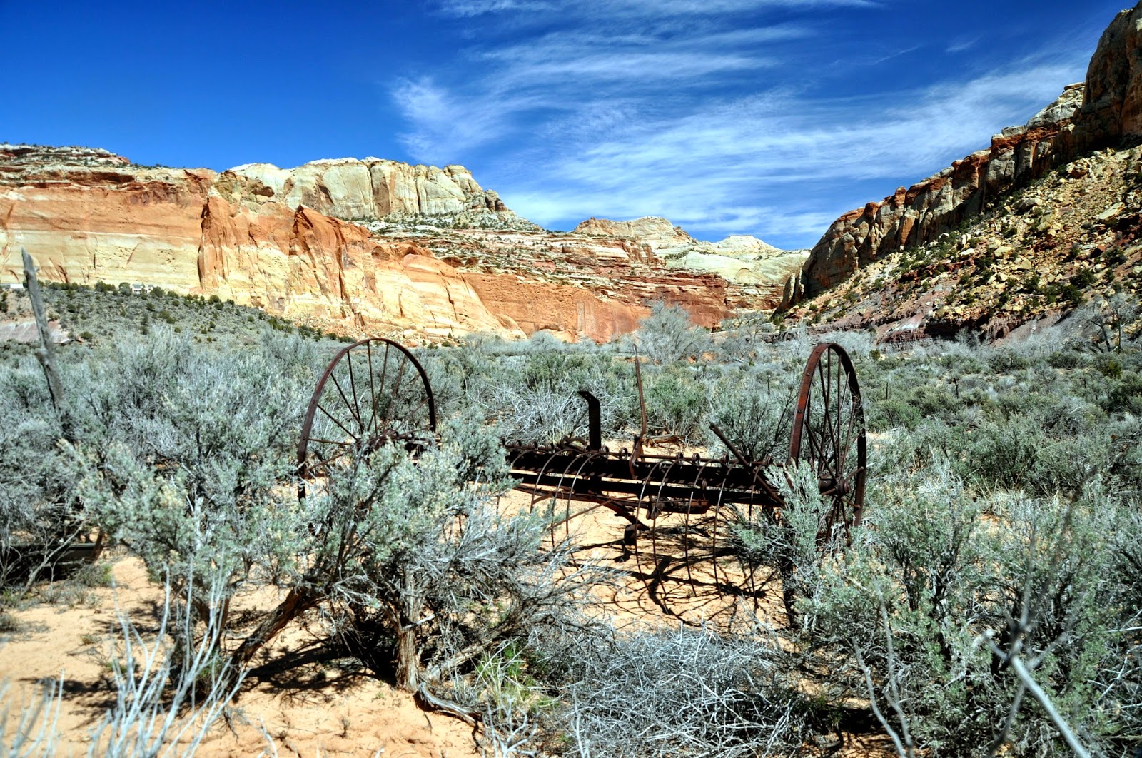
Abandoned Ranch
South Draw, Capital Reef National Park
Petroglyphs in Capital Reef National Park

Another days drive found us at Arches National Park. As usual we arrived expecting to find a campsite available. However, this park is so popular that all campsites are available by reservation only, all year round. The ranger at the gate suggested we try one of the campsites outside the park along the Colorado river on SR 128. We found a campground just a couple miles outside of Moab on the river. We actually found this to be more convenient since the campground inside the park would have meant a forty-five minute drive in or out of the park. This worked out well since we had local knowledge of a fine restaurant, Buck's Grill House on the northern edge of town. We enjoyed our first dinner there so much that we returned the next night to try other dishes on the menu that struck our fancy. 

In the park, we spent the better part of one day slowly driving the main road, stopping frequently to view the many rock formations and arches. The next day we drove west on SR279 that follows the Colorado River to reach the trail that took us to Corona Arch. Along this road are marvelous cliffs popular with rock climbers, well preserved petroglyphs and fossilized dinosaur footprints . Everyone knows how much Sarah loves petroglyphs, now I know how excited she is to see dinosaur fossils. 
Dinosaur Tracks

Petroglyphs near Moab

Corona Arch near Arches National park

After Arches National Park we transitioned from travel and explore mode to time to get home attitude. That's not to say we didn't enjoy the trip, but we knew it would not be possible to linger long at any one place. We were quite far north. While the weather report was good we knew an early spring storm could strand us. 

Friends of ours have built a summer home on the Rio Grande River near the scenic town of Creede, Colorado. Surprisingly, the river seems as large here as it is at Big Bend, Texas. Creede is less than twenty miles from the road on which we came over the continental divide so we decided that we could stop there for one night and park in their driveway. Creede is a small mining town popular with people who have built summer homes there and with visiting tourists. We enjoyed an evening drive into the mountains high above the town that afforded us fine views of the valley below and the mountains beyond.
Rio Grande River
near Creede Colorado

From Creede, we crossed the high plains of Eastern Colorado. But, before leaving the Rockies, we visited Great Sand Dunes National Park and Preserve to see the largest sand dunes in North America. We continued on and rested for the night at John Martin Reservoir State Park in eastern Colorado. This huge park on a man-made reservoir was nearly empty. But, it was a perfect place to stop for the night.
The magnificent dunes in Great Sand Dunes National Park and Preserve

Finding public lands for camping in Kansas is difficult. It has the least amount of public lands (as a percentage of acreage) than any other state. We set our sites on the Quivira National Wildlife Refuge, hoping to boondock for one night. But, for the first time in our travels, I neglected to pay attention to our fuel level. When we were 15 miles from our destination I noticed we had only about 25 miles of diesel left in our tank. Great Bend, Kansas was 18 miles to the north, the only place within fifty miles to buy fuel. We limped into town, filled our tank and chose to rest our weary bodies by making camp in the Walmart parking lot. We shared our 'campground' with four semi-trailers, a motorhome and a pick-up camper. Despite the all night commerce and blinding parking lot lights, we spent a comfortable night.

The next day brought us to Lawrence, Kansas at Clinton Lake State Park. This convenient to town location allowed us to spend a day visiting a college classmate and his wife before moving just up the road to Paola, Kansas where we stayed the night in the driveway of another college friend. 

Our final night of this travel season was spent at Ramsey Lake State Park, just east of St. Louis, Missouri. Once again, we were stop at Jackson Center, Ohio to leave the Mary Joan for more minor warranty repairs.

The drive to Jackson Center, Ohio could be done in one morning provided we got an early start. We arrived at the Airstream factory shortly after noon. We completed the paperwork necessary to affect the repairs required then spent a few hours preparing the trailer to be left unattended. Draining the water, dumping the holding tanks and securing the water lines with antifreeze took just a little over an hour. By 3 PM we were back on the road in order to be able to reach Massachusetts the next day.

We stopped for the night just east of Akron, Ohio and reached Massachusetts late the next afternoon. We returned to Ohio a few weeks later to retrieve the Mary Joan. We are now living in the Airstream while we supervise the repairs to our house.

Stay tuned

Wednesday, March 12, 2014

Lost Dutchman State Park and Rockhounding near Safford, AZ


Superstition Mountains as seen from Lost Dutchman State Park
The colors change daily and are especially dramatic at sunset
Our original plan was to stop in Superior on Saturday allowing us to arrive at Apache Junction, just east of Phoenix, on Sunday so that we would stand a good chance of getting a site in the overflow section of Lost Dutchman State Park being vacated that day. But, the campground we stayed in last year at Superior was closed forcing us to push on to Apache Junction. We drove into Lost Dutchman and were not surprised to see the sign announcing that all campsites, including the overflow were full. But, when the ranger approached he told us that the people using the group campground had left early and that we could camp there. The group campground is essentially a parking lot, but it suited our purposes for the night. The next morning I was able to succeed with the original plan of obtaining a site in the overflow campground.

None of the sites in the overflow section have electricity or water, but we were prepared to dry camp. Except for the microwave/convection oven, we could operate all systems on internal power and storage tanks. With bright sunshine everyday, our two solar panels had no problem keeping the batteries charged. At one time I saw 150 watts flowing into the batteries.
We had one rainy day, the Superstitions looked all that more mysterious
We had an appointment for 8AM on Monday with Gene's RV Repair in Mesa (http://genesrv.com/) to deal with our nonfunctioning refrigerator. Gene's is a family business. Gene's son, Mike, diagnosed our problem. We told him that we had read the warranty on the Dometic refrigerator that limited the warranty to the original purchaser and were prepared to pay for the repairs. When he found out that the previous owner had never used the trailer and had owned it for such a short time, Mike said he thought he could get the repair covered under warranty. Later that day, he called to say that Dometic would honor the warranty and a new cooling unit had been ordered, but that it was coming from the factory and would not arrive for a week. Our pleasure of having the repair covered by the warranty easily wiped out our disappointment of not having use of the refrigerator for that long.

When Mike learned we were using coolers and bags of ice to keep our food, he suggested using dry ice instead. Having never used dry ice or seen it for sale in stores I was surprised when he told me that Fry's, a local grocery chain, sold dry ice. We immediately went to Fry's, bought fifteen pounds of dry ice, put it on the top shelf of the refrigerator and placed the food on the lower shelves. The next morning we discovered frozen vegetables and ice crystals in the orange juice. We then wrapped the dry ice in a towel and when we needed to replace it, we used only one five pound block at a time. The dry ice was so much easier to use than regular ice because we didn't get food soaking wet as the ice melted and didn't have to deal with digging through the cooler to find what we needed or having emptying the melt water.

Another trailer chore was to visit an Airstream dealer, Desert Autoplex (http://www.desertautoplex.com/), that would inspect our trailer in order to transfer the remaining warranty to us. After filling out the paperwork and submitting the VIN number, the service agent returned to tell us that Airstream had already completed the transfer when we were at the factory for repairs the previous fall. As we were turning around to leave, he told us that our trailer brake and turn signals weren't working. He checked the electrical jack on the hitch and determined there was no power there. We then found that the fuse was blown. He went into the shop but returned saying he didn't have that fuse, but he would run down the street and get one. I objected, saying I could do that. He insisted though, saying it would only take a few minutes. As he promised, he returned promptly, replaced the bad fuse and all was well. I went into the office to find out what I owed, he said not to worry, there was no charge.

As usual we thoroughly enjoyed our stay at Lost Dutchman State Park. This park, just a short ride east of Phoenix is very popular with campers, hikers and horseback riders alike. At the foot of the Superstition Mountains and the southwestern entrance to the Tonto National Forest there are many hiking trails available, from the very easy to the extremely strenuous. The rangers and employees that tend to the park are very friendly and accommodating.

One evening we were treated to a special and beautiful scene in the western sky. The clouds formed a series of regularly repeating wave shaped forms on their eastern edge. This rare cloud pattern is known as the Kelvin Helmholtz waves. What we are seeing is stable moist air being lifted, condensed then sheared off as it rises into the less stable portion of the atmosphere.


Several evenings were spent listening and dancing to live music at either Filley's Road House or The Hitching Post saloons that were only a short drive from the park. Sarah and I both enjoyed the pizza at the Hitching Post. We understand why we saw so many people ordering it.

Two must do activities in Phoenix are to visit the Art Museum and the Desert Botanical Gardens. Of the several special exhibits at the art museum was a display of pins that former Secretary of State, Madeleine Albright, wore while she was our Secretary of State (http://www.phxart.org/exhibition/readmypins). This large and varied collection would be interesting even without the connection to Secretary Albright. But, the show underscores how even the most seemingly unimportant details can have dramatic importance in the sphere of international diplomacy. I have always admired her intelligence and dedication to her country. This exhibit cemented that admiration.

Her choice of pin always had an underlying meaning. Can you guess what attitude was represented by the wasp?

Having received nearly two inches of rain the week before our visit, the Desert Botanical Garden was a vastly different place than it was last year. Cacti and spring flowers were in abundance. Additionally, the Garden was hosting an installation of a number of large blown glass sculptures by artist Dale Chihuly (http://www.dbg.org/events-exhibitions/chihuly).
I'm sure this hummingbird enjoyed the spring flowers as much as I did.

Flowering Palo Verde tree


Chihuly's glass installations seemed so appropriate in the Garden


After two weeks at Lost Dutchman we had reached the limit for one stay so we retraced our steps to Safford and the Bureau of Land Management rockhound site in the Black Hills northwest of the town. On SR 191 at mile marker 141.5 is a gravel road that leads west for a mile and half to a small camping area. The sign at the cattle guard by the main road warns that the road is only occasionally maintained and could be rough. We found it to be in excellent condition. While it is narrow, we decided that if the road became too rough for the Mary Joan we could back up to a turn around spot. We turned into the camping area and found it could easily accommodate our 31' length.
View of the Black Hills and the White Mountains beyond from Safford, AZ

Once we had leveled the trailer, and set up camp, we drove another quarter of a mile further on the road we had come in on where we found a sign announcing that this was the center of the area where fire agate could be found. While there were small pieces littering the ground everywhere, we were unable to find any of any significant size. It was clear that the area had been mined with a mechanical sluice. Nevertheless, we did find a few pieces Sarah thought were worth keeping.

While we didn't strike it rich in our search for fire agate, we were rewarded with a wonderful campsite with the bonus of a fabulous sunset. Earlier in the day there had been low clouds and light showers. Just before sunset the front passed, the wind picked up and the sky cleared. We prepared our dinner after the sun set and by the time we finished eating the wind had dropped and we set up our telescope to view the stars as well as Jupiter and Mars.
Boondocking on BLM land in the Black Hills north of Safford, Arizona


The next morning we returned to SR191. In our atlas it is marked as a scenic state road.  The road is designated as a state road, the type on which we have towed the Mary Joan many thousands of miles. On Google Maps it appears to be a main highway. But, just a few miles from Clifford we saw a sign prohibiting trucks over forty feet in length. I couldn't believe that this road could be any more difficult than what we experienced on SR15 between Mesa Camp in Gila National Forest and Silver City. I decided to ignore the signs and proceed, hoping I would not have to explain why I ignored the warning.
Copper and Gold Mine. Not a rare sight in Arizona

The road was indeed very steep and the hairpin turns required strict diligence. Only on a few turns was I forced to cross the center line in order to keep the trailer on the road. Admittedly, a couple were on turns where I was blinded from oncoming traffic by the rock ledge on the inside turns. Fortunately, we met only two cars traveling in the opposite direction on the most challenging sections. We averaged only about 25 miles per hour for about forty five miles of this road. We were not in any hurry and we were enthralled with the views from this road.
High Mountain Range Land, White Mountains, Arizona off SR191
This evenings destination was Show Low Lake Campground. When we arrived, we found the main gate open, but the gate into the campground locked. The web site we looked at a few days earlier stated the campground was open year round. We drove past the gate to the campground and found a parking area that was shielded from street view by a thick stand of juniper trees. We later learned that this campground is run by a private firm, Recreation Resource Management of America, under contract with the city of Show Low. It seems that while the city is within the national forest, it maintains control of the natural resources within its limits. The next morning, rather than return to the main road the way we came, our GPS suggested continuing on the same road was the shorter route to SR260, our desired course A half mile further along the road we came to what was obviously the primary site of the Show Low Lake Campground on the opposite side of the road. It did appear to be open. Oh well, we enjoyed better views and it didn't cost anything.
Hidden away in Show Low

Next stop, Sedona, Arizona. Sarah and I are both excited. Stay tuned.

Saturday, March 1, 2014

Gila National Forest Without a Refrigerator

Valley of Fire Campground

In the Valley of Fire campground we met a man who, when we told him we were going to Mesa Campground in the Gila National Fores, advised that we not go the route we had planned. He said it is a very steep and winding road. Rather than approach from the east as we planned, he suggested going southwest of the mountains to Demming then approach from the west. I considered his advice, but the map indicated that it shouldn't make much difference.
Not the first one of these we saw

We drove west on New Mexico SR380 to San Antonio, south on I-25 through the town of Truth or Consequences where we stopped for lunch. Given that after my generation passes, few people will remember that the town is named for a television show that aired in the 1960s. Perhaps they will change it back to Hot Springs, which I think is more appealing and accurately reflects a feature of the town. At Caballo, we turned west onto SR152 then turned north on SR35. The road is very steep and winding and takes one to the western side of the continental divide. For nearly forty miles it climbs continuously at a grade of over 8% with numerous very tight switch backs. For the effort, we were rewarded with magnificent views of the valley from which we had just ascended.
Nearing the Continental Divide looking east

We chose, the Mesa Campground, run by the National Forest Service, because it is close to the Gila Cliff dwellings that we wanted to explore. The campsites at this campground are well spaced and they have 30amp electrical service and water. The price is $15 per night, but because we have the senior Golden Age Pass we paid only half price. 

Just to let us know!

Even though temperatures were in the upper 60s and lower 70s during the day, it got very cold at night. Our thermometer each morning told us the temperature was only in the upper teens. Because of this, we didn't hook up to the water. Rather, we used the water in our tank and refilled it before leaving.

Late in the evening on the day we arrived, we heard an odd thumping sound coming from the refrigerator. While investigating the strange noise, we noticed that the interior temperature had risen five degrees from its normal operating temperature. Clearly, it was not a happy refrigerator.

Unlike standard refrigerators used in most homes, the refrigerators in RVs do not use compressors in their operation. Those in RVs use a heat source, either propane and/or electricity, to heat ammonia in a closed system that causes the ammonia to pressurize. The ammonia then passes through a series of tubes where the pressure is released and absorbs the heat from the contents of the fridge. 

We knew from seminars we have taken that it is important that the refrigerator be level when operating, otherwise the condensed ammonia can precipitate, creating crystals that can block the flow of the liquid. What we didn't know was how much out of level and for how long we could run it before that would happen. Until now, we had always left the refrigerator running on propane while we traveled (remembering to turn it off whenever we pulled into a gas station or to refill the propane tanks). It seems we now had an answer. At least we know that two hours of steep uphill climbing when the temperature inside the trailer is 75 degrees or more is enough to cause a problem.

We were now forced to revert to the coolers filled with ice in the back of the truck to maintain our perishables . This required a three hour round trip ride down into the town of Silver City, which is the road our friend told us was the better way into Mesa Campground. That road, New Mexico state road 15, is as steep as Rt 35 that we came in on. However, it was much narrower and the switchbacks were even tighter. I was not looking forward to leaving Mesa Campground with the trailer, but I was glad I had a chance to reconnoiter and make plans on how and when to travel it.

After our trip into Silver City, we drove further up Rt 15 to the Gila Cliff Dwellings. The skill and hard work it took to build these structures was readily apparent. But, it was even more amazing to learn that the people only lived here for about forty years. 
High on the cliffs are the well preserved stone dwellings
Marvelous stone work

The next day we did a short hike into Purgatory Chasm. It is a loop trail of only about 3 miles, a pleasant morning stroll. We did the hike in a counterclockwise manner which turned out to be a nice way to do this hike. The trail led us up a long gentle slope through high meadows studded with Juniper and Pine trees. At the farthest point of the loop the trail turned and rewarded us with stunning views of the canyon by which route we would return. 
Purgatory Chasm, Gila National Forest

It struggles to survive as a tree, how did it hold on as a seedling?

One of the joys of our nomadic lifestyle, apart from perpetually being in spring weather, is meeting other interesting people who are also drawn to this way of traveling. At nearly every campground we meet such people, and the Mesa Campground was no exception. Because of our affinity for the Airstream brand, we are especially drawn to others who have also chosen Airstream for their home on the road. Here in the Gila National Forest we met fellow Airstreamers, Matthew Mayo and Jennifer Smith-Mayo. Matthew is a writer/editor and Jennifer is an accomplished photographer  (see their website here). They are full timers who left Maine to travel and do their work on the road. The ever increasing availability of the internet allows many people to continue to work while travelling. Jennifer and Matthew expressed mild dismay that they couldn't stay longer at Mesa Campground because it was one of the few places that had no cell phone availability and they needed to get some work done.
Mathew, Jennifer and Sarah

We planned a very early morning departure from the Gila National Forest in order to avoid traffic on the road to Silver City. I knew that we would need every bit of road space on many of the very sharp switch backs along the way. It took us 65 minutes to travel the 25 miles of steep mountain road to reach state route 70 that would take us into Arizona. 

A few miles south of Safford, Arizona we stayed at Roper Lake State Park. As we pulled into the park, there was a sign informing us that the campground was full. I was amazed that this could be since it was mid week and the main draw here was boating and fishing which was no where near high season. 

Experience has taught us never to believe such signs. Many times there are overflow areas where we can dry camp for a night or even a few days. Once again, our experience was reinforced. The volunteer working at the check in office told us that there actually was one campsite still available. She then told us that they were only renting out half of the campsites. She explained it had something to do with "budget cuts" for the park. I could not quite understand how that made sense. Leaving campsites empty that people are willing to pay for certainly couldn't help the park's finances, especially since much of the work in the state park's campgrounds is frequently done by volunteers. 

Before leaving in the morning I saw two young men outside their trailer letting their cat enjoy some sunshine and fresh air. Since we travel with Dot, our 15 year old cat, I approached them and asked how their cat liked traveling. This ice breaker led to us  talking with them for well over an hour. It turned out that they collected minerals and gems to make jewelry. Sarah sat and talked with Ben and Scott and was thrilled to see their collection. Moreover, they reminded us why Sarah had circled the town of Safford on the map last year when we came to Arizona. About 20 miles northeast of the town is BLM land where people are allowed to search for and collect gems and minerals. Since we had plans to be in Apache Junction by Saturday we couldn't justify going back, but I promised Sarah we would try to pass through there on our way home. 

With that promise made, we started for the town of Superior where we stayed the previous year. Our plan was to spend just one night then have a short ride to Lost Dutchman State park the next day. Besides the convenience, we wanted to dine once again at Jade Grill, an excellent restaurant in this small mining town. Unfortunately, the nearby campground we intended to stay at is now closed. We quickly searched for and found an RV resort just twenty minutes further toward Apache Junction. We decided to try to stay there. After All, a twenty minute drive to go to dinner was not unreasonable. However, that resort was full. All that was left to do was to push on to Lost Dutchman. We arrived late in the afternoon because we had dallied at Roper Lake believing there was no rush to get to Superior. At Lost Dutchman, all campsites including those in the overflow area were full. But, the ranger told us we could stay in the group camping parking lot for the night and try for one of the overflow spots that could become available the next day. We were happy to do that, and were lucky to get into the overflow campground in the morning. 

Now that we are settled in Lost Dutchman State Park, we will stay awhile so that we can have the refrigerator repaired, scheduled maintenance on the trailer performed and to visit relatives in the area.

Stay tuned.